Dialogue is also easy for me, since snark is one of my languages.
Aaron C. Cross – 4 April 2018
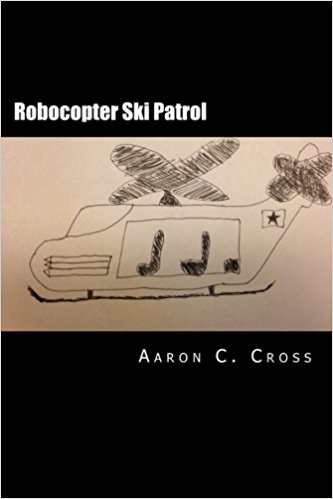
The Back Flap
The year is…some year. Let's say the present. Yellow cake uranium sits, waiting to be sold, in a foreign country. The leader hides himself away, fearing assassination – as he should, because that's how the country works. It's kind of a stupid country. And well he should worry, for skulking his way around Europe is an ambitious Baron just looking for the right opportunity to seize the throne and all the powers and chances that come with it. If only his pets would stop exploding… Across the ocean, Adam Bitchenstein attempts to win over Miss Girl from Ipanema for the nth time. However, a phone call from out of the blue will change everything in their lives forever. It's always a phone call, right? Join Adam, Miss Girl from Ipanema, and a cast of idiots and perverts as they seek to stop the balance of world power from changing before it's too late. Also, there's a Robocopter. Not sure if you picked that up but…it's kind of important.
About the book
What is the book about?
Essentially, it's a send-up of the cliché 'one last job' action movie trope, but it's more than that. Honestly, it's a bit difficult to describe, but the plot revolves around a dictator coming into power (in a stupid way) and the group of heroes looking to stop him. There's also some reality/time travel and a sentient helicopter.
When did you start writing the book?
I started writing the book proper back in, I think, 2010, though it was in stages before that.
How long did it take you to write it?
It took me three years, give or take a few months.
Where did you get the idea from?
The idea came from some friends when we were doing a play festival in Atlanta in 2009. We were sitting around and tossing around ideas and it got scribbled down on a sheet of computer paper. I still have that sheet, actually.
Were there any parts of the book where you struggled?
As with any book, there are difficulties. I can't think of a specific point at which the book was tricky, but I know there were some parts that just didn't click right away.
What came easily?
What was the easiest for me was that I gave myself permission to do whatever I wanted. If I wanted to write something, I put it in there. I actually have a note that demands that I justify why something CAN'T work. If I can't, it went in. Dialogue is also easy for me, since snark is one of my languages.
Are your characters entirely fictitious or have you borrowed from real world people you know?
The characters are mostly fictional, but I took bits and pieces of personalities from some of my friends at the time. Ace, in particular, is borrowed from a friend of mine that would get into scrapes while drinking. It seemed fitting.
We all know how important it is for writers to read. Are there any particular authors that have influenced how you write and, if so, how have they influenced you?
For influences, Terry Pratchett for sure. His whole giant universe and sense of humor speak to the heart of my writing. Writers like Mel Brooks, Matt Stone, Trey Parker, and the crew behind Archer also have an impact and I think that shows in the writing.
Do you have a target reader?
My target reader is anyone who wants to laugh. My goal in writing is just to create something to entertain others and that helps relieve stress and anger over the world at large.
About Writing
Do you have a writing process? If so can you please describe it?
It's not particularly pretty or specific. I try to write every single day and, sometimes, that just doesn't happen. Life and all that gets in the way. Still, my process is just to work on it when I can.
Do you outline? If so, do you do so extensively or just chapter headings and a couple of sentences?
It depends, but I really don't outline. My writing is mainly organic, in that it comes as it comes. I do try to have some plot points scribbled down in advance, just to keep me on track, but the story and characters go where they want and I've found that's the best way to really make the books interesting. I don't even name the chapters until I've finished writing them.
Do you edit as you go or wait until you've finished?
I usually wait until the end to do a full-scale edit. However, when there are days that writing isn't coming easily, I often go back and do some editing then to get myself refreshed on the story and see where I can go from there.
Did you hire a professional editor?
I don't, mainly because I can't afford it right now. Maybe if things take off a bit.
Do you listen to music while you write? If yes, what gets the fingers tapping?
Absolutely. Music really helps me writing. As for what, it varies. Some nights, it's heavy metal. Others, it's Latin jazz, Others, it's an 80s playlist. I don't really know until it happens, but it works well.
About Publishing
Did you submit your work to Agents?
I haven't as of yet. I've thought about it and explored it a bit, but ultimately I haven't felt comfortable doing that yet.
What made you decide to go Indie, whether self-publishing or with an indie publisher? Was it a particular event or a gradual process?
Going indie was just out of necessity. I was turned down from several MFA writing programs, which was disheartening, and decided to just write something and get it out there. A friend of mine, Ashley Wrigley, had self-published and was invaluable in helping me do so.
Did you get your book cover professionally done or did you do it yourself?
Well, for Robocopter, I took a whole five minutes to make sure that book cover looked as professional as it does. The others I actually used some default covers from my publishing website.
Do you have a marketing plan for the book or are you just winging it?
I just rely on word-of-mouth and having others read it and talk about it. I don't have the budget or time to go full-scale marketing right now, but I'd imagine that would change if circumstances were different.
Any advice that you would like to give to other newbies considering becoming Indie authors?
Just do it. Write. Publish. Even if it doesn't get traction, holding YOUR book in your hands is an incredible experience.
About You
Where did you grow up?
I honestly would say I grew up all over. I've lived in the Dakotas, Atlanta, Nashville, and in Oklahoma, so I've lived all over the United States.
Where do you live now?
Currently, I'm up in Fargo, North Dakota. No, we don't use woodchippers for people.
What would you like readers to know about you?
I'm a doctoral student that will hopefully have my degree within a couple years. Dr. Cross just sounds awesome, right? I can always be reached at www.aaronccross.com or via Facebook at https://www.facebook.com/RobocopterSkiPatrol/ or even Twitter as @daneatscatfood. I'm happy to talk to anyone about my books or about writing, so don't be shy!
A Pemi Loop, as it's known locally, is a 33 mile loop hike that follows the ridgeline encircling the Pemigewasset Wilderness. This 2-3 day route climbs TEN 4000 footers with 9000 feet of elevation gain and has long stretches of above-treeline travel, including a Bonds Traverse and a Franconia Ridge Traverse, two of the most scenic hikes in the White Mountains.
This is a tough hike, but one that you're unlikely to forget for the rest of your life. Some hard-core White Mountain peakbaggers try to hike the entire loop in 24 hours, but my preference is to spread the experience out over multiple days to fully enjoy the awe-inspiring views and star-filled skies at night. The route described below runs in a counter-clockwise direction around the Pemi because it provides better campsite opportunities for backpackers. You can also hike it counter-clockwise by reversing the directions.
The route follows the following trails in sequence. Refer to the AMC White Mountain Trail Map 2 – Franconia-Pemigewasset (2017 ed), which is the best waterproof map available for this region, although I'd recommend buying the complete AMC White Mountain Waterproof Map Set (2017 ed) rather than one map at a time. More detailed trail descriptions can be found in the AMC White Mountain Guide (2017 ed), which is considered the hiking bible for the region. Take photos of the pages using your phone for easy reference, instead of carrying the entire book with you on hikes.
Lincoln Woods Trail – 2.9 miles
Bondcliff Trail – 7.9 miles miles
West Bond Spur – 1.0 miles (out and back)
Guyot Shelter Spur – 0.4 miles (out and back)
Bondcliff Trail – 0.8 miles
Twinway East (optional out and back) – 2.6 miles
Twinway West – 2.0 miles
North Twin Spur – 2.6 miles (optional out and back)
Twinway – 0.8 miles
Frost Trail – 0.8 miles (out and back)
Garfield Ridge Trail – 6.4 miles
Franconia Ridge Trail – 5.0 miles
Osseo Trail – 4.1 miles
Lincoln Woods Trail – 1. 4 miles
Scenic Highlights
The following list provides cumulate distances on the route to each view or landmark.
Franconia Falls (optional side trip) – 2.9 miles (plus optional 0.4 mile side trail)
Bondcliff Mountain Summit – 9.1 miles
Mt Bond Summit – 10 miles
West Bond Summit – 11 miles
Guyot Summit – 12.3 miles
Zealand Mtn – (optional 4K side trip) 1.3 miles from Mt Guyot
South Twin Summit – 14.3 miles
North Twin Summit (optional 4K side trip) – 1.3 miles from South Twin
Galehead Hut – 15.1 miles
Mt Gale Summit – 15.5 miles
Garfield Lean-to and tentsite – 18.6 miles
Garfield Summit – 18.8 miles
North Lafayette Summit – 21.9 miles
Lafayette Summit – 22.5 miles
Greenleaf Hut (optional side trip) – 1.1 miles from Mt Lafayette
Lincoln Summit – 23.5 miles
Little Haystack Summit – 24.2
Liberty Summit – 26 miles
Mt Flume Summit – 27.5 miles
Camping/Shelter Options
USFS Franconia Brook Tentsite (Free) 20 tentsites available for overnight use. Caretaker in-season. First come, first served.
AMC Guyot Lean-to and Tentsite ($) The Lean-to accommodates 12, with 6 tent platforms. Caretaker in-season. First come, first served.
Natural water sources are plentiful in the White Mountains although you may need to descend to them from ridgelines along side trails if you run short. In any case, carry a detailed topographic map with you and don't rely on the overview map provided with this trip description to find water sources.
I also recommend purchasing the WMNF Pemigewasset Map in Guthooks Guide's New England Hiker Smartphone App (IOS, Android) which is a GPS guide to all of the trails, trailhead, shelters, campsites, views, and water sources in the White Mountains National Forest. I use it all the time and it is much more complete and current than using the maps bundled with the Gaia Smartphone App.
There are also several stretches along this route where it may be prudent to carry extra water. These include:
Franconia Falls Trail Junction to Guyot Shelter and Tentsite
Garfield Shelter Spur Trail to the Liberty Spring Tentsite
Weather Cautions
This route is sensitive to seasonal and weather conditions which can make it hazardous. This is particularly true for the above-treeline portions of trip which are completely exposed to the elements. The chief hazards are high wind (above 40 mph) which can make walking difficult, rain and cold temperatures which can lead to hypothermia, being struck by lightning, and poor visibility which can make trail finding difficult if you're not a strong navigator. If the weather deteriorates or is bad, get below treeline, consider ending your trip, or changing your route to where there is more vegetation.
Be sure to check the Weather.gov and Mt Washington Observatory Higher Summits forecasts before your hike. Updated weather conditions are also posted at all of the AMC Huts along the route. It's not unusual for experienced White Mountain hikers to postpone above-treeline trips and hike alternate, less exposed routes on bad weather days. The month with the greatest thunderstorm danger is July.
On the Trail
Cross the suspension bridge over the East Branch Pemigewasset River
Leave the Lincoln Woods trailhead and cross the suspension bridge over the East Branch Pemigewasset River. Turn tight at the other end and walk 2.9 miles down the Lincoln Woods Trail until you reach the Franconia Falls Trail junction.
The Lincoln Woods Trail is a major access trail leading into the Pemigewasset Wilderness
Before crossing the bridge over Franconia Brook to the Bondcliff Trail, you might want to take a short detour to check out nearby Franconia Falls, 0.4 miles down the side trail, on your left. Franconia Falls is a wonderful swimming hole, well worth returning to at some future point.
Lovely Franconia Falls
Crossing the wooden bridge to the beginning of the Bondcliff Trail, follow it down an old railroad grade that was once used to pull lumber out of the forest using horse teams and steam engines. At 4.7 miles, turn left and start climbing, still following the Bondcliff Trail, as it climbs alongside Black Brook, with several easy stream crossings. The last time I hiked this route, those stream crossings were unexpectedly dry so you might want to bring extra water, or check NETrailConditions.com for recent trip reports, to see if they mention water availability. The next reliable water is at the Guyot Lean-to and Tentsite at 12.3 miles.
Hike over old rail road ties along the Bondcliff Trail
At 8.8 miles, you'll scramble up a rock ledge that's often called "Hillary's Step" before emerging above treeline on Bondcliff Mountain, one of the most scenic cliff side traverses in the Whites. To the west (left), spreads Franconia Ridge, Owls Head Mountain, and the heart of the Pemigewasset Wilderness. This is a sight to behold and many people linger for hours absorbing the view.
Bondcliff Mountain Summit Viewpoint
Since Bondcliff is a cliff, use caution if you're accompanied by children or a pet. The trail is marked by rock cairns, which should be followed carefully, to avoid disturbing the sensitive alpine flora along the east side (rear) of the mountain. Stay well to the right (east) if it's windy, visibility is poor, or darkness has fallen. There's a reason the region below the cliffs is called Hellgate.
The trail runs along the top of Bondcliff for about a mile before climbing steeply up a boulder-choked trail to Mt Bond, which also has tremendous views to the east, including Mt Washington.
Bondcliff, seen from Mt Bond
Continuing north, descend the Bondcliff Trail to the West Bond Trail spur on your left, and follow it 0.5 miles to the West Bond Summit. The morning and evening views of Bondcliff from this viewpoint are quite breathtaking and it's well worth hiking from the nearby Guyot Shelter and Tentsite to experience them. While walking along the ridgeline of Bondcliff is quite an experience, seeing its rakish profile from West Bond is equally awe-inspiring.
Avalanches scar the face of West Bond Mountain
Return to the Bondcliff Trail, turning left, until you reach the Guyot Shelter Spur Trail. This is good place to camp because it has water and bear boxes, tent platforms, and a lean-to. During the summer months, you'll meet Appalachian Trail Thru-hikers who also stop to camp here.
Climb back up to the Bondcliff Trail from the Guyot Shelter Spur Trail and continue north towards Mt Guyot, an exposed dome-shaped peak, until you reach the Twinway Trail junction. If you want to climb nearby Zealand Mountain, also on the 4000 footer list, you can turn right (east) at the junction and hike 2.6 miles, out and back, to bag the peak. If not, turn left (northwest) and continue towards South Twin Mountain, in 2.0 miles, passing through the dense woods that border the trail.
South Twin Mountain
The Twinway pops back up above treeline at the South Twin summit, which also has tremendous views. In summer, you can often see glider pilots soaring on the thermals above. If you want to climb nearby North Twin Mountain, also on the 4000 footer list, follow the North Twin Spur Trail for 2.6 miles, out and back. If not, continue along the Twinway, descending steeply for 0.8 miles down a rocky trail, before arriving at the AMC's Galehead Hut.
AMC Galehead Hut
Day hikers are welcome to enter and visit the huts, where you can get out of the weather, check the forecast, and purchase snacks prepared by the hut crew. Water and bathrooms are also available.
From the Galehead Hut porch, it's just 0.4 miles up the Frost Trail to the Gale Mountain summit. There's also a nice ledge viewpoint on the left near to summit sign.
Return to the AMC Galehead hut and make your way to the Garfield Trail/Twinway Trail junction, at the end of the spur trail leading to Galehead Hut. Turn left onto the Garfield Ridge Trail and follow it over a series of small peaks for 2.9 miles to the Garfield Shelter Spur junction, where a piped water source is available on the immediate right. The trail is quite rough and rocky in this section, and often wet, so take your time hiking it.
Garfield Ridge Trail below shelter
Continue climbing the Garfield Ridge Trail, bearing left where the similarly named Garfield Trail enters from the right, and scramble over open ledges to the Garfield summit which has an old fire tower foundation. From Garfield, you can see the east side of Franconia Ridge, your next destination. South Twin Mountain, Owls Head, Bondcliff and many others can be seen from this fine viewpoint.
Franconia Ridge from the Garfield Summit
Retrace your steps to the Garfield Ridge Trail and dip below treeline again, heading southwest. Follow the ridgeline for 2.9 miles, climbing past the Skookumchuck Trail, which enters on the right. Ascend the north knob of Mt Lafayette, also called North Lafayette, once again climbing above treeline.
Climb North Lafayette following the rock cairns to Mt Lafayette
Follow the cairns to the Mt Lafayette summit in 0.8 miles, where the Franconia Ridge Trail begins. From Lafayette, you can see the Kinsman Range and Mt Cannon to the west, on the other side of Rt 302. On a clear day, you should be able to see all of the peaks to the west that you climbed earlier on this route, including Bondcliff.
Mt Lafayette and the Franconia Ridge Trail
When hiking the Franconia Ridge it's important to remain between the scree walls that demarcate the trail to avoid stepping on fragile alpine vegetation and potentially harming it. These slow-growing plants are buried in snow for all but a few months each year and have a hard time recovering if they're trampled and damaged. While it's tempting to roam over the open ledges on the east and west sides of the ridge, this trail is so popular in summer, that these plants are in serious jeopardy of disappearing forever.
Follow the Franconia Ridge Trail headed south
Follow the Franconia Ridge South as it travels over Mt Lincoln and Little Haystack until it reaches the Liberty Spring Trail Junction. If you need water, there's a spring down this trail at the AMC's Liberty Spring Tentsite in 0.3 miles.
Mt Flume in the foreground. Mt Liberty to the north
Continue south on the Franconia Ridge Trail for another 0.3 miles to the summit of Mt Liberty, which has a small but open summit. The trail follows a ledge down the south side, dropping into a col, before climbing again to the summit of Mt Flume in 1.1 miles. The Franconia Ridge Trail ends 0.1 miles south of the Flume summit, at a trail junction, where the Osseo Trail begins.
Follow the Osseo Trail descending steeply via wooden ladders at points
The Osseo Trail runs down Flume gradually at first and then more steeply, climbing down steep wooden staircases at points. In 4.1 miles, it reaches the Lincoln Woods Trail. Turn right at this junction and follow the Lincoln Woods Trail for 1.4 miles, turning left at the suspension bridge over the East Branch Pemigewasset River to the starting point of this route.
Written 2018.
About Philip Werner: Philip is the 36th person to finish hiking and backpacking all of the trails in the White Mountain Guide. He's also finished hiking many of the region's peakbagging lists including the White Mountain 4000 footers, the 4000 footers in Winter, the Terrifying 25, the RMC 100, and the Trailwrights 72. Philip is a 4 season backpacking leader for the Appalachian Mountain Club, a member of the executive committee for the Random Hikers, a Long Trail Mentor for Vermont's Green Mountain Club, and a Leave No Trace Master Educator. He also teaches several compass, GPS, and off-trail navigation courses each year, listed on Outdoors.org.
Safety Disclaimer
This trip plan can not alert you to every hazard, anticipate your experience, or limitations. Therefore, the descriptions of roads, trails, routes, shelters, tent sites, and natural features in this trip plan are not representations that a particular place or excursion will be safe for you or members of your party. When you follow any of the routes described on SectionHiker.com, you assume responsibility for your own safety. Under normal conditions, such excursions require the usual attention to traffic, road and trail conditions, weather, terrain, the capabilities of your party, and other factors. Always check for current conditions, obey posted signs, and Backcountry Camping and Wilderness Area Regulations. Hike Safe and follow the Hiker responsibility code. Disclosure: SectionHiker.com receives affiliate compensation from retailers that sell the products we recommend or link to if you make a purchase through them. When reviewing products, we test each thoroughly and give high marks to only the very best. Our reputation for honesty is important to us, which is why we only review products that we've tested hands-on. Our mission is to help people, which is why we encourage readers to comment, ask questions, and share their experiences on our posts. We are independently owned and the opinions expressed here are our own.
Things probably have seemed a bit quiet here at LR over the last month. No, we haven’t been toasting to our success while drinking out of coconuts in some tropical location. This story is even more exciting… Two years ago, we moved everything from WordPress to Rainmaker. You can read more about that here. At […]
Things probably have seemed a bit quiet here at LR over the last month. No, we haven't been toasting to our success while drinking out of coconuts in some tropical location. This story is even more exciting… Two years ago, we moved everything from WordPress to Rainmaker. You can read more about that here. At […]
A few years ago, ultralight backpacking used to require a religious conversion or at least a change in your packing "philosophy." Those days are over. You don't need to learn new skills or take a mentored backpacking trip if you already have some backpacking experience. Today, if you want to go light, toss out your old gear and just start from scratch. As long as you do a few low-risk shakedown trips before taking a more committing route, there's little downside to jumping in with both feet.
The Big Three
When it comes to weight reduction, the biggest weight reductions come from lightening the big three: your backpack, shelter, and sleep system, including a sleeping pad and whatever insulation you prefer, i.e. a sleeping bag or quilt. You'll be well on your way to ultralight nirvana if all you do is swap out your heavier kit for lighter weight versions of the same items.
Here are three suggested makeovers for these items to give you a feel the weight reductions that are possible at different price points. None of these items require much in terms of additional skill development.
For example, I've only listed tents that come with floors and bug netting and not floorless pyramids, flat tarps or other more extreme UL shelters like poncho tarps. If you switch from a sleeping bag to a quilt, you don't have to worry about a sleeping pad attachment system because the tent walls will block any drafts. Finally, all of the packs below have internal frames and should be easy to switch to if you already use an internal frame pack.
Why isn't hammock gear listed below? If you haven't used hammocks before they do require a significant amount of new skill development and the learning curve can be expensive. People who hammock are also generally more interested in comfort and less obsessed with gear weight. They still care about it, but not to the degree that conventional ground sleepers do.
Inexpensive Ultralight Makeover ($) – 91 oz for $648
While can spend a huge amount of money to swap out your existing backpacking gear for lighter weight alternatives, you don't have to. Granted, the $648 dollar (91 oz) Inexpensive Ultralight Makeover above isn't chump change, but it's a lot more affordable than the $1435 dollar (64 oz) Expensive Ultralight Makeover list. You'll have to decide whether it's worth spending $787 dollars to reduce the weight of your gear list an additional 27 oz (1 lb 11 oz). Just remember, a liter of water weighs 32 oz.
Furthermore, besides weight, there's no huge functional difference between the items on all three of these lists. While it is fun to get the lightest weight gear, there are quickly diminishing returns for your money. There's very little incremental value in buying the most expensive, lightest weight, backpacking gear, because the less expensive stuff listed above, will work just a well.
Now stop obsessing about your gear weight and go hike somewhere! The point is to get out and have adventures, not sit around indoors and surf lightweight backpacking web sites.
The most expensive gear is gear you never use.
Written 2018.
Disclosure: SectionHiker.com receives affiliate compensation from retailers that sell the products we recommend or link to if you make a purchase through them. When reviewing products, we test each thoroughly and give high marks to only the very best. Our reputation for honesty is important to us, which is why we only review products that we've tested hands-on. Our mission is to help people, which is why we encourage readers to comment, ask questions, and share their experiences on our posts. We are independently owned and the opinions expressed here are our own.
The My Trail Company Backpack UL 50 is new multi-day ultralight backpack that weighs 22 oz and is inexpensively priced ($119). I'd classify it a frameless backpack, although comes with a thin, removable foam stiffener in the back panel. It has a front stretch mesh pocket, mesh water bottle pockets, ice axe loops w/shaft holders, a unpadded hip belt, and a top drawstring closure. While it's reasonably comfortable with loads up to 30 pounds, the hip belt architecture is sensitive to pack weight and becomes noticeably less effective as you approach the high-end of its range. The Backpack UL 50 also comes with volume reducing clips at the base of the pack, so you can use to reduce its internal capacity to 20L (as long as you fully cinch down the side compression straps, according to MTC.) I discuss this feature more fully, below.
Specs at a Glance
Weight:
Total : 1 Lb 6 oz (actual, size medium)
Removable foam stiffener: 2.3 oz
Capacity: 50L, including extension collar according to MTC.
Max Recommended Load: 25-30 pounds
Bear Canister Compatibility: Vertical
Gender: Men's
Materials: 210d Nylon; high abrasion areas reinforced with Dyneema fibers.
The Backpack UL 50 is configured as an ultralight backpack with a large front mesh pocket and mesh side water bottle pockets. It has two tiers of side compression straps and dual ice axe loops with elastic shaft holders. The top of the pack closes with a drawstring with a webbing strap that runs over it and provides top compression. The inner compartment has a single hook for hanging a hydration reservoir with dual hydration ports above the shoulders. There's also an inner pocket on the back which contains a removable foam stiffener, which could be called a bivy pad if you were being generous.
The MTC Backpack UL 50 has a classic UL pack organization with a mesh front pocket and side water bottle pockets. The front mesh pocket has a key fob inside. Kind of an odd place for it…
At 50L, the pack is well sized for multi-day loads and is easy to pack with a rectangular-shaped back body and straight side walls. The mesh on the external pockets is fairly robust, but I wouldn't recommend taking this pack off trail where it's likely to get sliced up. The side water bottle pockets are large enough for two 1 liter bottles and it's easy to reach back, grab a bottle, and replace it without having to take the backpack off. The tall Smartwater bottles (favored by many backpackers) do have a tendency to fall out of the pockets when you put the pack down on the ground and it tips over, but that's not an issue if you're aware of it.
The top of the Backpack UL 50 closes with a drawstring leaving an opening that is susceptible to rain or dust
There isn't a speed lid or flap on top of the pack to cover the hole created by the drawstring closure. If you're like most ultralight backpackers, you'll probably line the inside of the pack with a plastic bag to keep your stuff from getting wet in the rain. Just make sure your liner is tall enough to fold over on top to prevent water or dust from reaching your gear. This pack would be a lot better if MTC had given it a roll top, but the lack of one isn't a show stopper.
Backpack Compression and External Attachment System
The Backpack UL 50 has two tiers of side compression straps that make it easy to lash gear to the sides of the pack. They're made with webbing and have buckles that clip together. That makes them a lot more useful if you want to carry wide, awkward items on the outside of your pack like a sleeping pad, tent body, snowshoes, or skis. Plus one, on that feature. The use of buckles also creates lots of places where you can anchor cord if you want to create your own custom attachment points on the back of the pack, like crisscrossed elastic cord for drying clothes.
The side compression straps have buckles which makes them far more useful for attaching bulky gear to the side of the pack.
The Backpack UL 50 also comes with a pair of clips and loops at the base of the pack that can be used to reduce its volume from 50L to 20L, as long as you cinch the compression straps to the max. If you deploy the clips without cinching the compression straps tight, you only reduce the pack's capacity by 5-10L, max. But this moves the load's center of gravity higher and puts much more pressure on the lumbar area of your back, uncomfortably so. This lumbar discomfort is still there if you do cinch the compression straps tightly, though it's more tolerable when carrying less weight. If you think the volume reduction clips make the Backpack UL 50 more attractive because you can use it as a daypack, think again. Get yourself a better day pack if you mainly plan to dayhike.
The shoulder straps are best suited for men, but not people with muscular chests or breasts.
Backpack Suspension System
The Backpack UL 50 is a frameless backpack with a unpadded hip belt. While it does have a thin foam stiffener inside, the main compartment barrels into your back if you overpack it. That's the nature of frameless backpacks without rigid frame stays or frames. You can mitigate any discomfort by not overstuffing the main compartment and by packing sharp cornered gear deeper in the pack, so it doesn't poke you in the back.
The shoulder pads are soft, mesh covered foam, but are tailored for men and not individuals with developed chests or breasts. There's an adjustable sternum strap (on a rail) and hydration hose keeper loops, but there aren't any daisy chains that would make it easier to attach pockets. Being frameless, they're no load lifters either, because there's nothing solid (like a frame) to attach them too.
The hip belt is just a nylon triangle sewn to the back of the pack
The hip belt consists of two triangular nylon panels sewn to the back of the pack with a simple wide webbing strap/buckle sewn on the end. The sewing is a bit rough on the inside and scratchy if it rubs against your skin. There are no hip belt pockets and the hip belt is not detachable, which is fairly common on frameless backpacks. If you have distinct hip bones with a prominent iliac crest, this hip belt will help transfer the load off your shoulders some, but I'd urge you to stay under the pack's max recommended load. If you have squarish hips or your hips are covered with an extra "layer," you'll probably experience some slippage. A thin layer of mesh padding sewn to the inside of the hip belt would have eliminated most of these issues. Also not showstopper, but noticeable.
Recommendation
The My Trail Company Backpack UL 50 is an inexpensive, frameless backpack that only weighs 22 ounces. It checks all of the "ultralight-style" backpack check boxes including a front mesh pocket, reachable side water bottle pockets, compression, and is made with durable fabrics. A 50 liter backpack like this is good for multi-day trips, if you have high volume, but relatively lightweight gear like a hammock sleep system that includes a tarp, quilt and under-quilt. I'd caution you however to avoid loading the pack beyond its max recommended load of 25-30 pounds, when it starts to become ungainly to carry due to hip belt slippage.
Disclosure: SectionHiker.com receives affiliate compensation from retailers that sell the products we recommend or link to if you make a purchase through them. When reviewing products, we test each thoroughly and give high marks to only the very best. Our reputation for honesty is important to us, which is why we only review products that we've tested hands-on. Our mission is to help people, which is why we encourage readers to comment, ask questions, and share their experiences on our posts. We are independently owned and the opinions expressed here are our own.
Yama Labs, a subsidiary of Yama Mountain Gear, announced the development of wheeled ultralight luggage made using Dyneema Composite Fabrics. Founder Gen Shimizu forecasts strong consumer demand for the company's ultralight travel luggage because "consumers are sick of using conventional wheeled travel luggage that weighs more than the stuff they've packed."
Part Japanese and part Pennsylvanian Dutch, Mr. Shimizu is renowned for his out-of-the-box design ideas in the ultralight backpacking world where hikers have been known to cut off the handles of their toothbrushes to reduce the weight of their backpacking gear. "The original idea for Ultralight Wheeled Dyneema Luggage came from my finance, who's a petite concert cello player. She's always struggled with a heavy cello case when traveling, so I decided to make one that was ultralight and wheeled, but that would also be sturdy and safe enough to transport her 18th century cello."
While fiberglass and carbon fiber cello travel cases exist today, the Yama's Wheeled Dyneema Cello Case is much lighter weight, only weighing 1.5 pounds, including wheels and hardware. "I've been working with Dyneema Composite Fabrics for over five years," says Shimizu, "and the stuff is magic if you know how to exploit its molecular structure."
Yama Labs developed a proprietary heating and molding process that anneals multiple layers of Dyneema together to create a hard case "that's stronger than steel, but light as a feather," says Shimizu. After extensive product testing, the company discovered that a black colored formulation was the most durable, hence the name "Obsidian Dyneema," which Yama has trademarked.
The first set of bags and cases made using Yama's Obsidian Dyneema includes a wheeled carry-on, hard golf-club case, hard ski case, and a hard cello case. Priced between $350 and $1200, they're available for pre-order today, with delivery later in 2018. For ordering information, contact Yama Mountain Gear, 1304 East Market St, Suite V, Charlottesville, VA 22902.