
Carter Dome is the ninth tallest White Mountain 4000 footer with an elevation of 4832 feet. It's located almost due east of Mount Washington and has the distinction of being the highest mountain in the Carter Moriah Range. Most of the peakbaggers who climb Carter Dome approach it from the east and climb to the summit via Zeta Pass.
This Carter Dome route takes a less-travelled approach and climbs the summit from the west, before descending to the Wild River Wilderness and looping back through Perkins Notch. One of the highlights of this route is the open summit of the South Knob of Carter Dome, which at 4274 ft, is a 4000 footer in its own right, even though it's not listed on the official AMC 4000 footer list. It has an excellent view of Mt Washington, which makes up for the viewless Carter Dome summit. From Carter Dome, the route drops back into the Wild River Wilderness down the Black Angel Trail, one of the prettiest and most remote trails in the Whites. This loop is especially beautiful to hike in early October when the leaves begin to change color.
Carter Dome Wild River Loop Backpacking Trip PlanRating/Difficulty
****/4 out of 5
Distance/Elevation Gain
21 miles with 4400′ of elevation gain
White Mountain 4000 Footers
- Carter Dome
Recommended Duration
2-3 days
Season
June thru October
Permits Required
None.
Regulations
Backcountry Camping Regulations for the White Mountain National Forest.
Trailhead Directions
- Bog Brook Trailhead – Follow Carter Notch Road 5.4 miles from the junction of NH16B and NH16A in Jackson, NH. This turns into a gravel road at it approaches the end of the road. Pass by a large parking lot on your left at the top end of Carter Notch Rd, and continue down a short hill onto FR 233 for about half a mile, passing a back woods shack (we call them camps) labelled "Camp Gout." The Bog Brook Trailhead parking area will be on your right shortly.
Trail Sequence
The route follows the following trails in sequence. Refer to the AMC White Mountains Trail Maps 5-6: Carter-Range-Evans Notch North Country-Mahoosuc (2017 ed), although I'd recommend buying the complete AMC White Mountain Waterproof Map Set (2017 ed) rather than one map at a time, because it's less expensive that way. Detailed trail descriptions can also be found in the AMC White Mountain Guide (2017 ed), which is considered the hiking bible for the region. Take photos of the relevant pages using your phone for easy reference, instead of carrying the entire book with you on hikes.
- Bog Brook Trail – 2.8 miles
- Wild River Trail – 0.7 miles
- Rainbow Trail – 3.5 miles
- Carter Moriah Trail – 0.4 miles
- Black Angel Trail – 4.9 miles
- Wild River Trail – 5.8 miles
- Bog Brook Trail 2.8 miles
Scenic Highlights
The following list provides cumulative distances on the route to each view or landmark.
- Rainbow Trail Birch Tree Grove – 3.5 miles
- South Knob of Carter Dome Summit and Viewpoint – 6.0 miles
- Carter Dome Summit – 7.0 miles
- Wild River Trail Junction – 12.3 miles
- Spruce Brook Tentsite – 13.1 miles
- No Ketchum Pond – 16.5 miles
- Perkins Notch Tentsite – 17 miles
Camping and Shelter Options
- USFS Spruce Brook Campsite (Free) – pressed earth tent pads, water
- USFS Perkins Notch Campsite (Free) – pressed earth tent pads, water
Water
Natural water sources are plentiful in the White Mountains although you may need to descend to them from ridgelines along side trails if you run short. In any case, carry a detailed topographic map with you and don't rely on the overview map provided with this trip description to find water sources.
I also recommend purchasing the WMNF Wild River Map in Guthook Guide's New England Hiker Smartphone App (IOS, Android) which is a GPS guide to all of the trails, trailhead, shelters, campsites, views, and water sources in the White Mountains National Forest. I use it all the time and it is much more complete and current than using the maps bundled with the Gaia Smartphone App.
Note: There is no water from the north end of the Bog Brook Trail until about half way down the Black Angel Trail along this route and you may want to carry a bit extra.
On the Trail
Begin at the Bog Brook Trail trailhead. There are three water crossing in the first two miles that are usually rock hopable, but may be difficult to cross in high water. You can also bypass them by following the gated FR 233 road to the intersection of the Bog Brook trail with the road. While slightly longer, your feet will stay dry. I'd recommend staying on the trail though, since it is quite pretty and the road walk is boring.

Merge onto the Wild River Trail for a short distance until you come to the Rainbow Trail Junction.

Turn left onto the Rainbow Trail and follow it through a grove of birch trees and berry bushes (in the summer months) which are popular with moose and bear. Most of the birch trees are dead due to climate change and disease, but are quite a sight nonetheless. If you're concerned about a large animal encounter, make a lot of noise and hike with a partner or small group. The animals are afraid of you and will leave the area if you alert them to your presence.

Continue ascending through scrappy woods until you reach the open summit of the South Knob of Carter Dome, also referred to as South Carter Dome. On a sunny day, you can clearly see Mt Washington and its glacial cirques, Tuckerman Ravine and Huntington Ravine ,to the west.

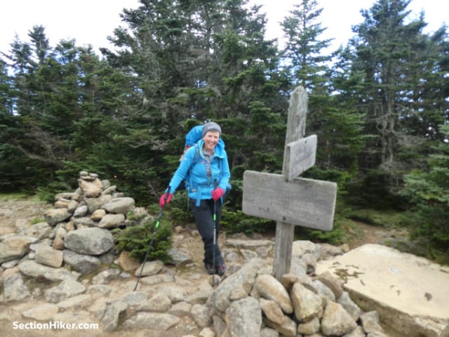
Proceed through the summit krummholz (dwarf trees) for an additional mile to the open summit of Carter Dome. The site of an old fire tower, you can still see the tower foundations and find assorted historical debris from when it was taken down, in the nearby woods. One man's trash is another man's treasure: these items are considered archeological artifacts and it is against the law to disturb or remove them.
From the summit trail junction, hike north along the Carter Moriah Trail towards Mt Hight. Turn right onto the Black Angel Trail after 0.4 miles before you reach Hight and descend for 4.9 miles down to the Wild River Trail.

The Black Angel Trail is considered to be one of the most beautiful trails in a region full of beautiful trails. Most of it is easy hiking, but there are a few rock scrambles along the top of the trail which can sketchy if the rocks are wet or covered with ice. The trail crosses into the Wild River Wilderness shortly after leaving the Carter Moriah Trail and while it is lightly blazed, the trail can be more difficult to follow in autumn when leaves cover the obvious trail tread.

When you reach the Wild River Trail, the path follows closely beside the upper reaches of the river to its source in No Ketchum Pond. They say that the wild trout fishing along this section of river is out of this world. It's also takes a heck of a walk to get to, which probably keeps the fishery so vibrant and wild.

In 0.8 miles, you'll reach the Spruce Brook Tentsite spur trail which climbs steeply uphill to several packed earth tent pads. The fire ring is located near the entrance sign along the Wild River Trail, down where the old lean-to used to be before it was removed. The pads are spaced widely apart and there's plenty of privacy. If you plan to hike the route in two days, this is an excellent place to stop for the night.

Continue south along the Wild River Trail, crossing a stream just beyond the Spruce Brook Tentsite. It is rock hopable, although you may want to hike upstream a bit to find an easier crossing point. Continue past the Eagle Link Trail Junction, following old logging skid roads and over newly constructed bog bridges. Passing the East Branch Trail Junction, just before another stream crossing. No Ketchum Pond will soon come into view on your right, followed by the Perkins Notch Tentsite on your left.

Continuing east along the Wild River trail, you'll soon arrive at the Rainbow Trail junction you passed previously before climbing up to Carter Dome. Retrace your steps from the previous day along the Wild River and Bog Brook Trails back to the trailhead parking lot.
Safety Disclaimer
This trip plan can not alert you to every hazard, anticipate your experience, or limitations. Therefore, the descriptions of roads, trails, routes, shelters, tent sites, and natural features in this trip plan are not representations that a particular place or excursion will be safe for you or members of your party. When you follow any of the routes described on SectionHiker.com, you assume responsibility for your own safety. Under normal conditions, such excursions require the usual attention to traffic, road and trail conditions, weather, terrain, the capabilities of your party, and other factors. Always check for current conditions, obey posted signs, and Backcountry Camping and Wilderness Area Regulations. Hike Safe and follow the Hiker responsibility code.Published 2018.
Help support this site by making your next gear purchase through one of the links above. Click a link, buy what you need, and the seller will contribute a portion of the purchase price to support SectionHiker's unsponsored gear reviews, articles, and hiking guides.The post Backpacking a Carter Dome Wild River Loop Trip Plan: Backpacking the White Mountain 4000 Footers Guidebook appeared first on Section Hikers Backpacking Blog.
from Section Hikers Backpacking Blog https://ift.tt/2DbdDsg
No comments:
Post a Comment