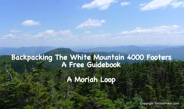
The Moriah Loop is a 2-3 day, 24 mile backpacking route that climbs Mount Moriah and its graceful sister peak, Shelburne Moriah, before dropping down to the Wild River. From there, the route loops back through the heart of the Wild River Wilderness on the Moriah Brook Trail, passing countless cascades and pools that make for great backcountry swimming. Seldom visited by day hikers, this wilderness area is remote and lightly blazed, requiring good map-reading skills and navigation experience.

Rating/Difficulty
****/5 out of 5
Distance/Elevation Gain
24 miles w/5800′ of cumulative elevation gain
White Mountain 4000 Footers
- Moriah
Recommended Duration
2-3 days
Season
June thru October
Permits Required
None.
Regulations
Backcountry Camping Regulations for the White Mountain National Forest.
Most this route passes through the Wild River Wilderness Area. Please observe all wilderness area restrictions.
Trailhead Directions
- Stony Brook Trailhead
- Carter Moriah Trailhead (very limited parking – see parking recommendation below)
This trip starts the Carter Moriah Trailhead and ends nearby at the Stony Brook Trailhead. These are separated by a 1.3 mile road walk, all downhill, that takes about 20-25 minutes. If you only have one car, I'd recommend leaving it at the Stony Brook lot and getting the road walk out of the way up front. Turn left from the Stony Brook parking lot onto Rt 16 and walk 1.3 mile, turning right into the Libby Pool parking lot on Mill Street. Leave the parking lot on Mill Street and turn right onto a bridge in 0.2 miles. Cross the bridge and take a right onto Bangor Street, which quickly leads to the Carter Moriah Trailhead. You can also park at the Libby Pool lot (the sand covered part) if you have two cars, instead of trying to park at the Carter Moriah Trailhead, which has very limited parking.
Trail Sequence
The route follows the following trails in sequence. Refer to the AMC White Mountains Trail Maps 5-6: Carter-Range-Evans Notch North Country-Mahoosuc (2017 ed), which is the best waterproof map available for this region, although I'd recommend buying the complete AMC White Mountain Waterproof Map Set (2017 ed) rather than one map at a time, because it's less expensive that way. Detailed trail descriptions can also be found in the AMC White Mountain Guide (2017 ed), which is considered the hiking bible for the region. Take photos of the relevant pages using your phone for easy reference, instead of carrying the entire book with you on hikes. Getting the 2017 editions is important because there have been changes to the trail system.
- Carter Moriah Trail – 4.5 miles
- Kenduskeag Trail – 5.1 miles
- Shelburne Tr – 3.4 miles
- Highwater Tr – 1.7 miles
- Moriah Brook Trail – 5.5 miles
- Stony Brook Trail – 3.6 miles
Scenic Highlights
The following list provides cumulative distances on the route to each view or landmark.
- Mt Surprise Summit – 2.0 miles
- Carter Moriah Summit – 4.5 miles
- Shelburne Moriah Summit – 7.2 miles
- Wild River – 11.6 miles
- Moria Brook Gorge – 13.9 miles
- Moriah Brook Cascades – 15.4 miles
Camping and Shelter Options
- Imp Lean-to and Tent Platforms ($)
- Wild River Campground ($) – Closed for 2018 for renovation and repair.
- There are limited options for backcountry camping on this route given the terrain. Your best bet for finding a campsite is along the Shelburne Trail (below 1800′), the Highwater Trail, or the lower half of the Moriah Brook Trail. Please observe all White Mountains backcountry camping rules and wilderness regulations and leave no trace.
Water
Natural water sources are plentiful in the White Mountains although you may need to descend to them from ridgelines along side trails if you run short. In any case, carry a detailed topographic map with you and don't rely on the overview map provided with this trip description to find water sources.
I also recommend purchasing the WMNF Wild River Map in Guthook Guide's New England Hiker Smartphone App (IOS, Android) which is a GPS guide to all of the trails, trailhead, shelters, campsites, views, and water sources in the White Mountains National Forest. I use it all the time and it is much more complete and current than using the maps bundled with the Gaia Smartphone App.
On the Trail

Begin climbing the Carter Moriah Trail which climbs 3250′ feet over 4.5 miles to the summit of Mount Moriah. The trail is easy to follow, but this is a significant climb so take your time in ascending. Water is also scarce, as noted above, so pack extra.

At 2.0 miles you'll come to a rock ledge known as Mt Surprise which has a good view of Pine Mountain on the other side of Rt 16. From this point onward, the trail to Moriah switches from forest duff to rock ledge, gaining elevation steeply in places.

Continue climbing until you come to a spur trail on your right to the Moriah Summit. There are very fine views of Mt Washington and the northern Presidentials from the summit. If you turn and look to the north, you can see the summit ledges on your next destination, Shelburne Moriah Mountain. Once you summit that peak, you'll follow the ridge on its righthand side down to the Wild River Valley.

Return to the Carter Moriah Trail and turn right. In a few steps, you'll come to a rock chimney that you need to down-climb. The best way I've found to descend these is to go down backwards, like climbing down a ladder, grabbing hand and footholds as you climb down.
At the bottom, turn left onto the Kennduskeag Trail where you'll encounter numerous boardwalks on the way to Shelburne Moriah Mountain. This first section of the Kenduskeag Trail coincides with the Appalachian Trail and you're like to to encounter thru-hikers or section hikers until the AT turns off at the Rattle River Trail Junction, 1.4 miles distant.

Continue on the Kenduskeag Trail past the Rattle River Trail junction, walking on more bog bridges until you pop out above treeline near Shelburne Moriah Mountain. The views from the top of this 52-with-a view peak (3735′) are probably the best in the Carter Moriah Range. There's a fine view looking back at Mt Moriah and Middle Moriah to its right. In clear weather, you can also see Mts Washington, Jefferson, Adams, and Madison. Turning north, you can see the entire Mahoosuc Range, which is also on the Appalachian Trail, and the Androscoggin River below it.
Head east from the Shelburne Moriah Summit, descending steeply to the Shelburne Trail Junction. Until now, the route has skirted the Wild River Wilderness, following its northwestern boundary. When you reach the junction, turn right, where you'll be greeted by the Wild River Wilderness boundary sign. Hang gliders are not permitted in the wilderness area, so leave yours at the boundary.

If you're low on water, there is a small stream at 2300′ and another larger one at 1800′. If you're beat for the day and ready to camp, there are lots of locations on either side of the trail to camp in the open woods. The next major stream crossing at 1400′ is also a good area to find a backcountry site.
At 1400′ you'll pass outside the designated wilderness area. Continue to the Highwater/Shelburne Trail junction where Bull Brook meets the Wild River. This junction can be a little confusing because the sign you need to follow is hard to see as you come down the trail. When you see the sign announcing a Forest Protection Area on your right, turn right and look for sign that says "Highwater Trail, Moriah Brook 1.4."

From here, there are two small stream crossings separated by a small island. Chances are you'll need to bushwhack to the left around the island and back around the other side because dead trees from the annual spring floods get hung up on it, blocking the trail. Look for a small wooden sign, nailed to a tree, on the other side of the second stream crossing to find the continuation of the Highwater trail.
The Highwater Trail runs along the west bank of the Wild River for 1.4 miles, occasionally climbing above the river, before it turns onto the Moriah Brook Trail. While the Forest Service tries valiantly to keep this trail open year after year, the Wild River erodes the river bank each spring or after heavy rain events. So don't be surprised if the riverside sections of trail disappear for short stretches because it's been washed away. If you keep the Wild River to your left, bushwhack these areas, until you find the trail on the other side of the washout. You can't overshoot the Moriah Brook Trail junction, as long as you stay in sight of the Wild River.

Shortly before you come to the Moriah Brook trail junction, you'll pass a sign pointing to the Wild River Campground. This is the site of a former suspension bridge, which was closed in 2016 and has since been washed away. But the sign is a good indicator that you're still on the right track.
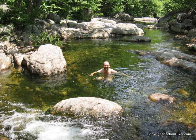
The Highwater trail is intact from this point on, until you turn right onto the Moriah Brook Trail in 0.3 miles. Moriah Brook is a rocky mountain stream that runs up a narrow river valley for 5.5 miles. The place has a lost world feel to it, with countless cascades and pools that make for excellent swimming and relaxing. Few people venture down the Moriah Brook Trail, although it is a local favorite among backpackers.
After a mile, you'll come to the Moriah Brook Gorge, a small canyon that drops 300 feet to the Wild River below. The top pool below the water crossing is a great place to take a dip and cool off. The rest of the gorge is accessible, but requires considerable effort to explore.

Cross the river at the top of the river and hike upstream through open forest. Like the Wild River, portions of the Moriah Brook Trail are periodically washed out by seasonal flooding, so don't be surprised if sections are obscured by blowdowns or flood debris. If you lose the trail, just remember that it runs alongside the brook.
While the trail leads to many attractive swimming holes, there are portions of Moriah Brook that you can only get to if you're willing to hike off-trail to access them. If you have the time and inclination, it's well worth spending an extra day along the Moriah Brook to investigate them. There is also a sparse trout population in the stream, making it a fun place to Tenkara fish if you have the patience.
As you hike higher along the Brook, the valley begins to narrow and the trail starts to weave back and forth across the stream. Some of these stream crossings are obscure, so pay close attention to your map to avoid getting pulled off trail by a herd paths to pre-existing campsites. The valley narrows as you approach the southern cliffs of Mt Moriah. This section can be muddy, but you soon climb out of it reaching the Carter Moriah Trail.

Take a left at the Carter Moriah Trail and follow the boardwalk 20 yards to the Stony Brook Trail junction. Take a right onto the Stony Brook Trail which descends steeply at first but then moderates. Follow it for 3.6 miles, past a gorgeous stream, with numerous swimming holes, until you reach the trailhead parking lot at the end of this route.
Safety Disclaimer
This trip plan can not alert you to every hazard, anticipate your experience, or limitations. Therefore, the descriptions of roads, trails, routes, shelters, tent sites, and natural features in this trip plan are not representations that a particular place or excursion will be safe for you or members of your party. When you follow any of the routes described on SectionHiker.com, you assume responsibility for your own safety. Under normal conditions, such excursions require the usual attention to traffic, road and trail conditions, weather, terrain, the capabilities of your party, and other factors. Always check for current conditions, obey posted signs, and Backcountry Camping and Wilderness Area Regulations. Hike Safe and follow the Hiker responsibility code.Published 2018.
SectionHiker.com receives affiliate compensation from retailers that we link to if you make a purchase through them, at no additional cost to you. This helps to keep our content free and pays for our website hosting costs. Thank you for your support.The post A Moriah Loop Trip Plan: Backpacking the White Mountain 4000 Footers Guidebook appeared first on Section Hikers Backpacking Blog.
from Section Hikers Backpacking Blog https://ift.tt/2t8pfFU
No comments:
Post a Comment