
The Fire Warden's Loop is a 2-3 day, 18 mile backpacking route that climbs four 4000 footers: Hale, Zealand, South Twin, and North Twin. All four of these peaks surround the Little River Valley but aren't normally climbed together as a group by day hikers because there isn't an obvious loop to follow. While there's a trail from the North Twin Trailhead to North Twin Mountain, there's not a well-known trail linking Hale to the valley floor.
However, there used to be a fire tower on Hale (removed in 1972) and a road leading to it that was named the Mt Hale Trail. It's known today as the Fire Warden's Trail and is still used by winter hikers and backcountry skiers to climb Hale when the roads to trails on the other side of the mountain are closed in winter. That old trail has been kept open (although it's not listed in the White Mountain Guide or Appalachian Mountain Club Maps) and makes it possible to climb all four peaks in a continuous loop. This isn't atypical in the Whites. There are a lot of old logging roads and herd paths used by hikers that aren't "officially" recognized, but are still widely used. Their routes are frequently available in apps and online mapping programs that incorporate open-source GPS data like the GaiaGPS app and Caltopo.com.
This trip starts with an ascent of Hale on the Fire Warden's Trail, before dropping down to the AMC's Zealand Hut on the Lend-a-Hand Trail. From there, it climbs to an open cliff called Zeacliff, which has a great view of Zealand Notch and the Whitewall Mountain Cliffs. After passing a small alpine lake called Zeacliff Pond, hikers summit Mt Zealand, followed by Mt Guyot. Next, the route follows the Twinway to South Twin Mountain, before traveling out to North Twin Mountain and dropping steeply down to the route's beginning in the Little River Valley.

Rating/Difficulty
****/3 out of 5
Distance/Elevation Gain
18 miles w/5600′ of cumulative elevation gain
White Mountain 4000 Footers
- Hale
- Zealand
- South Twin
- North Twin
- West Bond, Mt Bond, Bondcliff (optional extension)
Recommended Duration
2-3 days
Season
June thru October
Permits Required
None.
Regulations
Backcountry Camping Regulations for the White Mountain National Forest.
Trailhead Directions
Trail Sequence
The route follows the following trails in sequence. With the exception of the Fire Warden's Trail, refer to the AMC White Mountains Trail Map 2: Franconia-Pemigewasset (2017 ed), which is the best waterproof map available for this region, although I'd recommend buying the complete AMC White Mountain Waterproof Map Set (2017 ed) rather than one map at a time, because it's less expensive that way. In addition to the GeoPDF and GPX file found attached to this route plan, the Fire Warden's Trail is clearly marked in the GaiaGPS App (iPhone & Android) on the Gaia Topo Base Map.
Detailed trail descriptions can also be found in the AMC White Mountain Guide (2017 ed), which is considered the hiking bible for the region. Take photos of the relevant pages using your phone for easy reference, instead of carrying the entire book with you on hikes.
- North Twin Trail – 1.0 miles
- Fire Warden's Trail – 2.1 miles
- Lend-a-Hand Trail – 2.7 miles
- Twinway to Zealand Mountain Spur Tr – 2.8 miles
- Zealand Mountain Spur Tr – 0.2 miles (out and back)
- Twinway to Bondcliff Trail Junction – 1.3 miles
- Twinway to South Twin Summit – 2.0 miles
- North Twin Spur Trail – 1.3 miles
- North Twin Trail – 4.3 miles
18 miles with 5500′ elevation gain.
Scenic Highlights
The following list provides cumulative distances on the route to each view or landmark.
- Mt Hale Summit – 3.1 miles
- Zealand Hut – 5.8 miles
- Zeacliff – 7.0 miles
- Zeacliff Pond – 7.4 miles
- Zealand Summit 8.7 miles
- Mt Guyot Summit – 10 miles
- South Twin Summit – 12 miles
- North Twin Summit – 13.3 miles
Camping and Shelter Options
- AMC Zealand Falls Hut ($$$)
- Large Pre-existing Campsite off Ethan Pond Trail (Free) – This campsite is located near the Forest Protection Area perimeter boundary surrounding Zealand Falls approximately 1/2 mile south on the Ethan Pond Trail and is predominantly used by Appalachian Trail Thru-hikers. It's flat and has space for many tents.
- Guyot Shelter and Tentsite (Platforms) ($)
- AMC Galehead Hut ($$$)
Water
Natural water sources are plentiful in the White Mountains although you may need to descend to them from ridgelines along side trails if you run short. In any case, carry a detailed topographic map with you and don't rely on the overview map provided with this trip description to find water sources.
I also recommend purchasing the WMNF Pemigewasset Map in Guthook Guide's New England Hiker Smartphone App (IOS, Android) which is a GPS guide to all of the trails, trailhead, shelters, campsites, views, and water sources in the White Mountains National Forest. I use it all the time and it is much more complete and current than using the maps bundled with the Gaia Smartphone App.
On the Trail
Follow the North Twin Trail for 1.0 miles to the first river crossing. Just before the trail reaches the river bank, turn left onto an unmarked side path and follow it for 0.4 miles, staying close to the hillside on your left. Look for a tree up a slight incline on your left that has had a blaze chopped into it, and turn left hiking uphill to continue on the Fire Warden's Trail.
Note: Chopping blazes into trees violates the principles of Leave No Trace. Most White Mountain Hikers were horrified to discover that someone had marked the trail in this manner since it's so unnecessary, and it violates White Mountain National Forest Regulations.
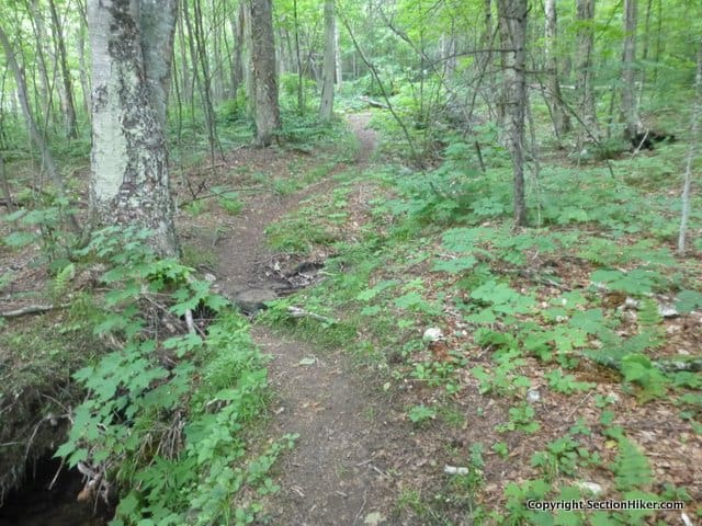
The Fire Warden's Trail, like many trails in the White Mountain National Forest, is largely unblazed. However, the trail is still heavily used and the path is easy to follow. Running along an old road bed, the trail is a well beaten path, with surprisingly few rocks to clamber over as it climbs uphill. If you encounter a tree blocking the path (called a blow-down), just detour around it and the path will continue heading uphill on the other side.

As you approach the summit of Hale, there a good view through trees of Mt Washington's east side and the ridgeline between Mt Jefferson and Mt Monroe. The Fire Wardens Trail runs directly to the Hale summit which is viewless. It has a large rock cairn at the top, with magnetic rocks that can play tricks on your compass.

From the Hale summit, follow the signed Lend-a-Hand Trail which runs down to the Appalachian Mountain Club's Zealand Hut. When you reach the section of this forest trail that has wooden boardwalks, slow your pace way, way down to avoid slipping and falling on them if they're wet. If you do fall, try to land on the base of your backpack where you're sleeping bag is packed because it will cushion the fall.
When you arrive at the hut, drop your pack on the porch and go inside to visit with the crew. You don't have to be a paying guest to visit and it's a good place to stop for a rest and refill water bottles from the indoor taps. The Hut is also a good place to spend the night if you want to follow this route at a leisurely pace. Reservations are highly recommended though, especially in the summer and autumn.
All of the huts, major junctions, and fragile areas of the Whites are surrounded by Forest Protection Areas (FPA), usually 1/4 to 1/2 mile in diameter, where camping is prohibited. They're all marked by signs nailed to trees that announce when you're entering or leaving them. While I can't recommend it, there is also large pre-existing campsite on the Ethan Pond Trail, south of the Zealand Hut, near the perimeter of the FPA surrounding Zealand Falls. Heavily used by AT Thru-hikers, it's not the prettiest campsite by a long shot, but you can camp there for free in a pinch.

Leave Zealand Hut and climb up the Twinway Trail to Zeacliff, a cliff face that overlooks Zealand Notch and the Whitewall Mountain cliffs on its far side. The climb up to Zeacliff is steep and rocky, ascending 900 feet in 1.2 miles, but it's the last significant climb on the route. At the top of the climb, follow a signed side trail to the viewpoint. There's a good view of Presidential Range in addition to the cliffs.

From the cliff, head north along the Twinway which is the major trunk trail along the northern rim of the Pemigewasset Wilderness. It also coincides with the Appalachian Trail, so you're likely to run into thru-hikers between July and September as they head towards Maine.
As you approach Zealand Mountain, you'll pass a 0.1 mile side trail to tiny Zeacliff Pond on your left. Depending on the year and the time of season, Zeacliff Pond may be beautiful or just plain nasty. It does have a great view of Mt Carrigan in the distance though, which is well worth checking out. Local naturalist Alex MacPhail has a wonderful description of the pond's origins on his White Mountain Sojourn Blog, that's worth a quick read if you're interested in mountain pond ecology and the geological forces that help create them. For instance, I learned that the difference between a pond and a lake is whether or not sunlight can reach the bottom.

Continue along the Twinway until you reach the 0.1 mile spur trail that leads to the Zealand Mountains summit. The summit is viewless and hemmed in by spruce, with barely enough space to get your photo under the sign. While it may feel like you're not on a 4000 footer, rest assured, you're at 4260′ of elevation. That's the beauty of ridge walks, something that the White Mountains has in abundance. Once you climb to a ridge crest, you can hike along it picking off one summit after another, with less incremental effort.
Continue along the Twinway towards Mt Guyot (pronounced Gee-oh, with a hard 'g'.) The mountain is named after Professor Arnold H. Guyot(1807–1884), who's credited with drawing the first map of the White Mountains. Guyot is a 4000 footer although it's not on the AMC 4000 footer list because its summit is too close to other peaks that are.
That's the funny thing with peakbagging lists, they are not a literal reflection of the landscape (The Adirondack 46ers 4,000 footer list contains several peaks less than 4,000 feet in height), but very much a man-made abstraction. For example, Guyot is considered a 4000 footer on another White Mountains peakbagging list called the Trailwrights 72, which lists 24 additional mountains that are 4000 feet or higher, beyond the 48 peaks included on the AMC 4000 footer list.

Guyot is a pretty peak with a graceful bald summit dome topped with rock cairns. It's also a major crossroads linking the Bondcliff Trail to the Twinway, putting the Bonds (West Bond, Mt Bond, and Bondcliff) within spitting distance if you want to add them to this route. The Bondcliff Trail also leads to the AMC's Guyot Shelter and Tent Platforms in 0.8 miles, which is a good place to camp (the only nearby place to camp) or refill your water if you're running low.

From the Guyot summit, continue northwest on the Twinway, passing through dense woods, to the summit of South Twin Mountain, where t he view of Franconia Ridge and Mt Garfield more than makes up for the lack of views on Mts Hale and Zealand. On a clear summer days, you can even see hang gliders soaring above Franconia Ridge on the hot air thermals.

From South Twin, turn right onto the North Twin Spur Trail, reaching the summit of North Twin in 1.3 miles, passing open ledges with more great views. There's also a short side trail from the summit cairn to another ledge overlooking Mt Garfield and its sub-peaks, which is a great place for lunch or to admire the view.
Continue onto the North Twin Trail, which descends steeply down to the Little River Valley for 4.3 miles. The descent requires three stream crossings, which can be difficult in high water. Being a steep and narrow valley, the Little River can flash up quickly during a heavy rain event, so check the weather during the dates of your hike to avoid heavy rain. If you do find yourself unable to cross safely during high water, wait for the water level to drop until it's safe to cross. The Little River has a small watershed and the levels will drop quickly.

After the final water crossing, it's a short walk back to the North Twin Trailhead where this route began. If it's warm out, there are many fine cascades and pools along the river where you can swim and cool off. I haven't found any trout yet in this section of the Little River, but your luck may be better,
Safety Disclaimer
This trip plan can not alert you to every hazard, anticipate your experience, or limitations. Therefore, the descriptions of roads, trails, routes, shelters, tent sites, and natural features in this trip plan are not representations that a particular place or excursion will be safe for you or members of your party. When you follow any of the routes described on SectionHiker.com, you assume responsibility for your own safety. Under normal conditions, such excursions require the usual attention to traffic, road and trail conditions, weather, terrain, the capabilities of your party, and other factors. Always check for current conditions, obey posted signs, and Backcountry Camping and Wilderness Area Regulations. Hike Safe and follow the Hiker responsibility code.Published 2018.
SectionHiker.com receives affiliate compensation from retailers that we link to if you make a purchase through them, at no additional cost to you. This helps to keep our content free and pays for our website hosting costs. Thank you for your support.The post The Firewarden's Loop Trip Plan: Backpacking the White Mountain 4000 Footers Guidebook appeared first on Section Hikers Backpacking Blog.
from Section Hikers Backpacking Blog https://ift.tt/2KsRPIo
No comments:
Post a Comment